SEARCH
World Walk
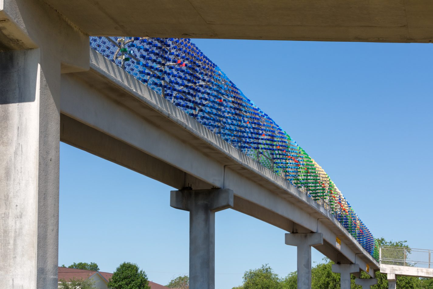
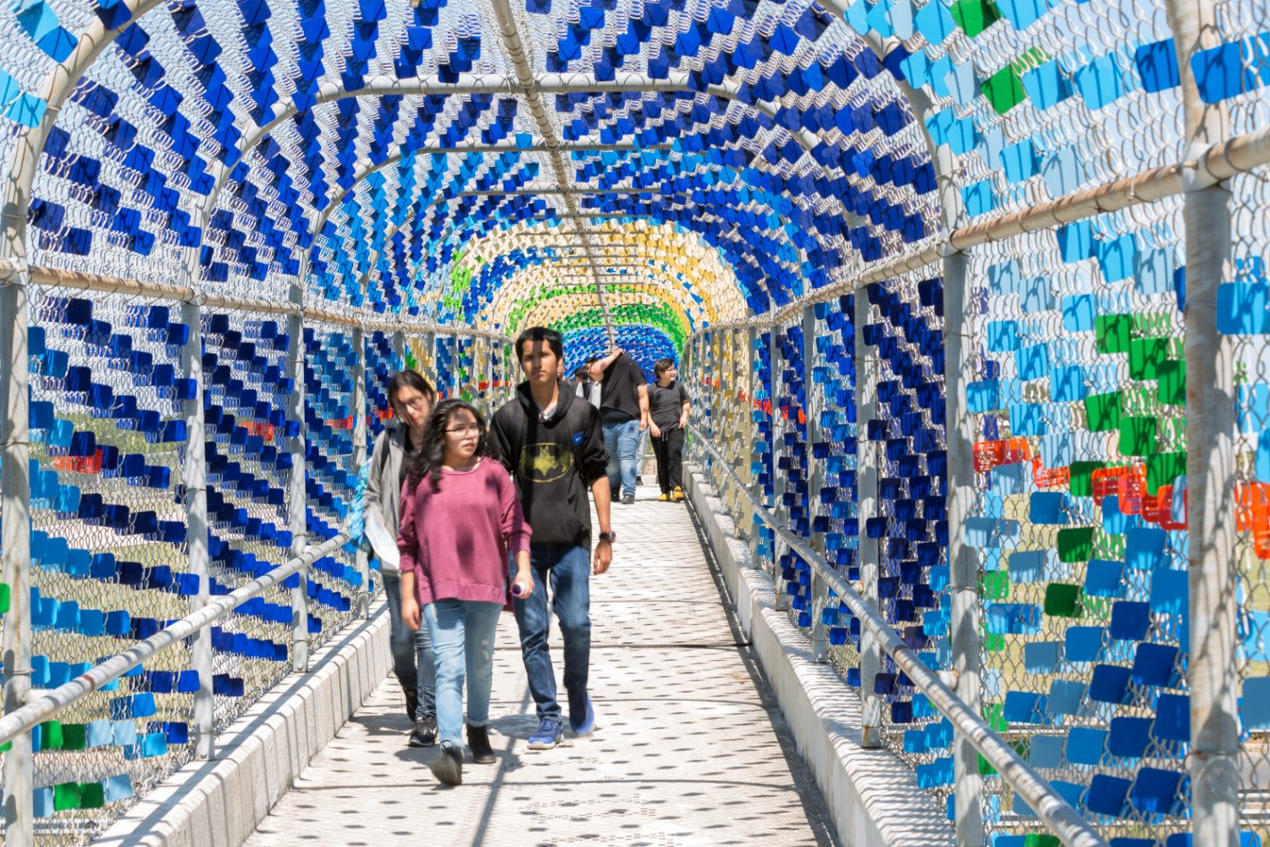
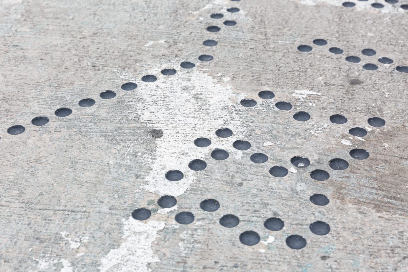
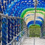
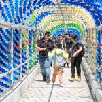
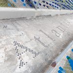
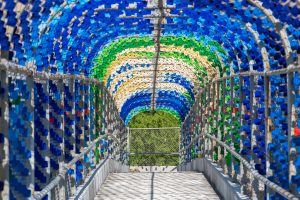
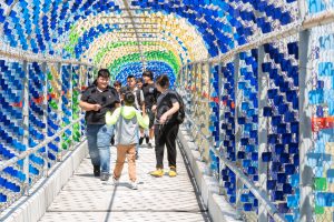
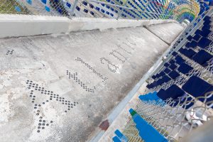
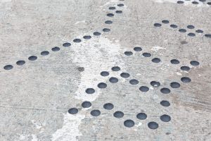
“World Walk” by Austin based artist team Legge Lewis Legge; Murray Legge, Deborah Eve Lewis, and Andrea Legge transforms the bridge into an immersive atlas. Scaled to the bridge span and starting and ending in San Antonio, this strip of the globe spans latitudes 25ºN to 35ºN and runs for 24,900 miles all the way around the world. The artwork asks viewers to imagine that with each step you take along this 230-foot bridge you pass through forests, deserts, the tallest mountains on earth, the deepest ocean trenches, regions populous and deserted – before arriving back at the point where you started: San Antonio, Texas. The artist team created the immersive atlas by installing 7,430 pairs of steel tabs, powder coated in 12 different colors, onto the existing chain link fence mesh directly over the highway. The colors correspond tothe climate zones around the globe – lush greens for forested areas, a range of blues for the oceans, and tans for the deserts and mountainous regions. The abstract colors are given context with 4,020 dimples etched into the concrete bridge span outlining countries, continents and oceans as the viewer walks across the bridge. In addition to the climate regions, a vibrant red tab identifies geographic or cultural features present in the corresponding map location. These features were developed in collaboration with students of Abraham Kazen Middle School.
Location: Infrastructure/Streets


Location
9402 Poteet Jourdanton Fwy, San Antonio, TX, 78224
Additional Information
Accession Number: 2016.LEW.1
District: 4
Location: Pedestrian Bridge
Artist URL: http://www.leggelewislegge.com/
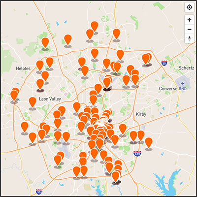
EXPLORE OUR MAP